Middle Ages Maps
Welcome to History Link 101's Middle Ages Map Page. Here you will find excellent links maps of the Middle Ages.
Centers of Learning in Middle Ages As well as other Middle Ages Maps.
Visual = 5 Content = N/A
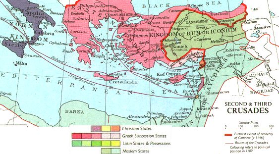
D3010
Map
of the Second and Third Crusade From Fordham.
Visual = 5 Content = N/A
D3030
Map
of the Forth Crusade From Fordham.
Visual = 5 Content = N/A
D3040
Clickable
map of Florence
Visual = 5 Content = N/A
D3050
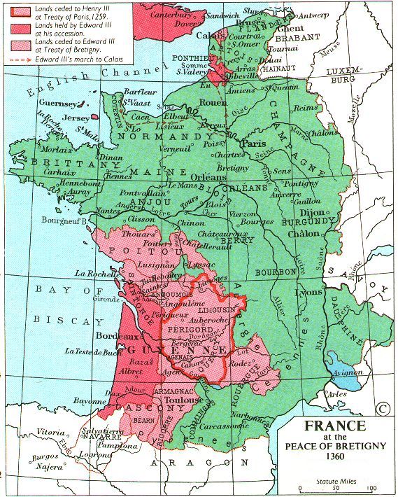
Fordham Maps of France
France
1360 D3060
France
1429 D3070
France
late 15th Century D3080
Visual = 5 Content = N/A
Early
Medieval Maps Index of 175 Cartographic Images from 400 A.D. to 1300 A.D.
Visual = 5 Content = N/A
D3090
European
Historical Maps From Perry-Castaneda collection from the University of Texas at
Austin. Large collection.
Visual = 5 Content = N/A
D3100
European
Maps from 700-1600 A.D. Click on maps to enlarge.
Visual = 5 Content = N/A
D3110
Invasions
of the Barbarians Click on the blue name for descriptions of the different
invasions.
Visual = 5 Content = 3
D3120
Medieval
Map Links Over 70 maps site links. Developed by Fordham.
Visual = 5 Content = N/A
D3130
Late
Medieval Maps Index of 200 Cartographic Images from 1300 A.D. to 1500
A.D.
Visual = 5 Content = N/A
D3140
Medieval
Trade Routes Showing four major cities and their trading routes.
Visual = 5 Content = N/A
D3150
Medieval Trade Routes Across Asia
Visual = 5 Content = 2
D3160
Renaissance
Maps Index of 800 Cartographic Images from 1500 to 1700 A.D.
Visual = 5 Content = N/A
D3170

